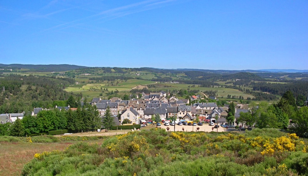
Village of Aumont-Aubrac
#Discover
Aumont-Aubrac is located in the northwest of the Lozère department, between the granite mountains of the Margeride and the volcanic plateaus of the Aubrac, at an altitude of 1,050 meters. The village sits at a historical crossroads: the Roman road Agrippa, the Via Podiensis for pilgrims on the Way of St. James, the Paris-Béziers railway line, the N9 national highway, and the A75 motorway. Today, Aumont-Aubrac is a popular stop on long-distance hikes and has held the “Village Etape” (Stopover Village) label since 2002.

Un peu d'histoire
The origins of Aumont-Aubrac remain unclear. However, according to the earliest historical documents, the village already existed around the year 1000. It is believed to have gradually developed around a fortified priory, founded by the Barons of Peyre, considered the most powerful barony in the Gévaudan region. At that time, the village stretched from the church to the site of the current town hall.
Originally, the village was called “Altus Mons,” meaning “high mountain.” This name referred to its commanding position, higher than Gabalum, the ancient Gallo-Roman capital—now Javols, located just 7 km away. Later, the village was called “Almont” until the end of the 17th century, before becoming simply “Aumont.” Finally, in 1937, it officially took the name “Aumont-Aubrac”, also adopted by the local station, which at that time constituted the last stop serving the Aubrac plateau.
exploring the village
Priory House: Founded in the 11th century, it housed a small religious community. The current building dates from 1684. After the priors passed away, it served as a barn and then a cheese cellar. Purchased by the town hall in 1989, it was renovated and has housed the Aubrac Lozérien tourist office since 1993.
Saint-Étienne Church: A former Benedictine monastery dating from the 11th century, destroyed by Protestants in the 16th century and subsequently restored. Its bell tower was built in 1937. The interior was renovated in the 1960s, featuring beautiful stained-glass windows. It is an important site for pilgrims on the Way of St. James (Camino de Santiago).
Truc del Fabre and Christ the King: A small hill topped by a statue of Christ the King, erected in 1946. It commemorates the survival of the inhabitants during the Second World War. Panoramic view of the village.
Fairground Square: A former fairground dating back to the 19th century. Today, it hosts the farmers’ market every Friday. The inhabitants are nicknamed “Berduros,” a reference to the village’s horse dealers.
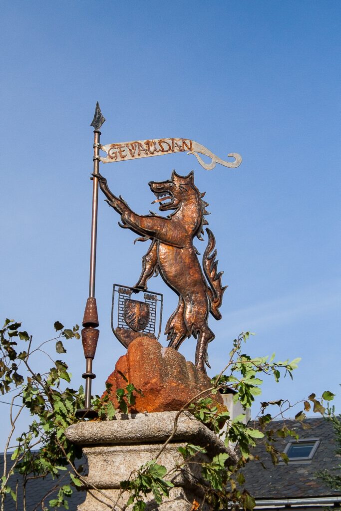
Statue of the Beast of Gévaudan: Installed in 1992 in the Place du Portail, it recalls the legend of the beast that terrorized the region in the 18th century.
Mysterious Stone: An engraved stone located beneath the Mater Dolorosa statue, of uncertain origin. The engraved symbols have given rise to several hypotheses, including a possible link to the former priory.
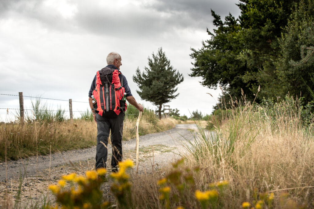
Starting on foot from Aumont
Looking to get some fresh air? Starting from Aumont-Aubrac, two hiking trails will take you on a journey to discover the landscapes, forests, and viewpoints surrounding the town.
Download the detailed hiking guides for each route for free: distance, duration, difficulty level, trail markings… everything you need to plan your outing with complete peace of mind.
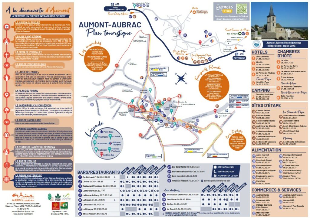
Map of Aumont-Aubrac
To better prepare your visit, download the village map for free. Find all the points of interest, shops and trails to explore!